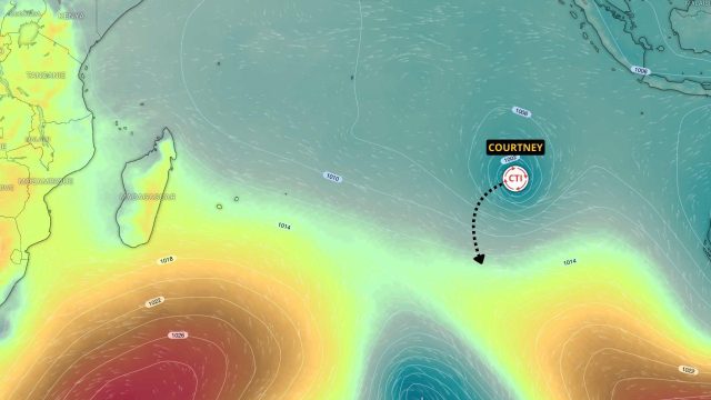
Powerful tropical cyclone COURTNEY is entering the southwest Indian Ocean basin. With a perfectly defined eye and gusts reaching 260 km/h, it will be addressed by RSMC La Réunion. Fortunately, its forecast path poses no threat to inhabited land, as it will quickly move south.
A powerful, intense tropical cyclone
COURTNEY is putting on its best clothes before entering the southwest Indian Ocean basin. Indeed, the system is a robust, intense tropical cyclone with a beautiful satellite signature. The compact core is remarkably symmetrical, while the eye is circular with well-defined contours.
This is therefore a powerful system that will be addressed by RSMC La Réunion in the coming hours. According to analysis by TCWC Perth, sea gusts near the eye are estimated at 260 km/h, with a central pressure of 947 hPa.
No threat to inhabited land areas
COURTNEY could further intensify in the short term. However, the window of intensification is closing soon. A significant increase in wind shear is expected very soon. This situation should lead to a gradual weakening of the system as it moves over the southwest Indian Ocean.
The area of development and the projected track allow us to confidently state that COURTNEY poses no threat to inhabited land areas in the basin. Indeed, the track will quickly turn southwest and then south, leaving the system at the eastern end of the basin.


